blackdogsailor

Posts Tagged ‘tennessee’

Three Years Ago Today

In long haul, Uncategorized on 07/11/2013 at 08:08

I launched my Macgregor on this day in 2010. I have traveled a little 0ver 4000 miles on the Ohio, Cumberland, Tennessee, Little Tennessee, and the Tom-Bigbee waterway. Some of these repeatedly. I encourage you to check the archives.

first four days 032

first four days 022

Day one and 35 pounds heavier

This morning I am in Florence Harbor. I left Joe Wheeler embayment yesterday at sunrise and Headed south. My goal was 47 miles. I got hung up at Wheeler and had to wait with a good 20 mph wind out of the southeast. after 60 minutes of taking a beating standing post on through we went. I got hung up at Wilson for 2 hours again taking a beating, thus Florence harbor

Not many photos of the last couple of days because of the wind all day. Hard to roll with the rollers and take pictures. My left hand was on the grab rail most of the time.

I got this great picture of clouds coming over me from my stern. Imagine standing under a piece of glass and having paint poured over the top.

P1010858

Starboard

P1010859

port-pretty Groovy huh.

P1010874

The biggest drop in America. The Wilson Lock.

Well I am outta here for now. I have until Sunday to go about 50 miles. I already used one marina day and I will anchor out until then.  I also blew some money on some fried mushrooms.

Happy birthday Barb.

Dr Brad standing by on 16

Headwaters Then Heading South

In On the river on 06/09/2013 at 10:16

I have not posted for awhile I have been oh so not busy and have no excuses. I mentioned last post that I did make it to the Tennessee River headwaters and here they are.

P1010794

This is the center between the Holston River to port and the French Broad River on starboard.

P1010793

The French Broad River

P1010792

The Holston River

P1010790

Headwaters from about a quarter mile. I am at mile 652. I have traveled every one of them by water.

P1010785

This is Knoxville as I head back down river.

P1010800

I spent the night here downtown

And the next day I am off and heading to Goose Pond

P1010804 (2)

Just a blue moon

P1010827

A pretty picture from Jones Creek

P1010749

P1010826

All day everyday

Well I am back at goose pond. I am rich with $46 in my pocket.

I had two scares during the trip. I stopped on 8/23 just above Watts Bar dam. my anchor got rapped around a limb that had been weighted and dropped for fish attraction. The line was seriously wound up. I had to go in the water and spend 15 minutes diving and untangling to get free. This was the first time on the whole trip all 4000 miles of it I have been hung up like that. The second scare was rain on the river.  I was just out of Ft. Loudon in a narrow channel when it started raining to beat the band. It was raining so hard I could not see more than 10 feet in front of the boat. This went on for 20 minutes. I couldn’t stop I couldn’t see what was coming. I didn’t know if I was in the channel or not. What did I do?

I went on the radio with a securite , securite announcing my speed and river mile and slowed to about 4mph- just enough to handle the current and steerage. I steered by plot charter kinda like instrument only flying. my only big fear was hitting a log. I had seen quite a few big ones usually about 4 or 5 a day. I puckered up and and made it. That’s why we have life jackets ( which I wear all the time) and insurance. I also could have hit the horn for 5 short bursts every 30 seconds which is a warning signal. Honestly I forgot that one.

As usual I get back and spend too long not contacting friends. I will do better. I guess. If I have to.

P1010729

P1010659

P1010654

P1010683

P1010692

P1010686

Gotta love it.

Dr Brad Standing by on 16.

No More Red Right Return

In On the river on 21/08/2013 at 17:20

I still have a few problems with the PC. I am contributing this to old age, not me , the computer. Red right return means going up river you keep the red nun buoys on your right. I am now heading back down river and I am down bound with the green cans on my right.

Well I made it up to end of the navigable water on the Little Tennessee River and what is referred to as Tellico Lake.

P1010751

You can see the Great Smokey Mountain. The last ten miles of the navigable waters – beautiful.

P1010758

Great Smokey mountains

P1010760

Sight of the Cherokee town of Chota. Each stone represents a clan. The clans were Deer, Wild Potato, Wolf, Paint, Bird, Long Hair and Bird. This town had been in existence since the the late 1600 hundreds.

P1010759

You can barely see the marker for  the town where the the town Tanasi was located as the capital until 1731. We all know what the President from Tennessee did to the Cherokee.  What sate and river get their name from this village? Duh…

P1010779

This is Fort Loudoun. This fort was taken by the Cherokee when they turned on the British during the War of 1763. They did this after the British executed Cherokee civilians in the Carolinas. The United States tried to keep settlers from encroaching on Cherokee land toward the end of the 18th century by building another fort nearby but we know how that  worked out.

Tellico lake itself is clear and cold and the best water quality I have seen on my trip. The problem with The lake is it never had to be built. It serves no purpose for the TVA. The farmers who had to sell their land got next to nothing and the Congress of the United States passed a law exempting the lake construction from environmental regulations.

So what you end up with is mile after mile of million dollar homes stacked 20 feet apart for 20 miles. The TVA originally made the farmers sell all their land and have no water front property with the promise that the lake would remain natural and forested. All I’m going to say about this is some folks, maybe in government,  maybe not, made millions and millions of dollars off grandpa’s farm. All we need is a floating Starbucks next to the 6000 square foot boat house to complete the scene.

Not a big entry but next we’ll do the headwaters of the Tennessee.

Dr Brad standing by on 16

Gorge, Fault, Escarpment

In On the river, The TN Gorge on 06/08/2013 at 15:53

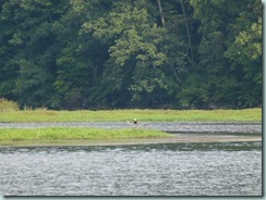
I have been out four days from Goose Pond Marina. Started off stopping at Jones Creek on Saturday. Beautiful anchorage surrounded by large hills.
P1010651

That’s an eagle at Jones Creek

P1010653

P1010654

Jones Creek like a whole other lake.

Then it was on thru Nicklejack. The day was kinda long but I locked thru Sunday afternoon.
P1010660

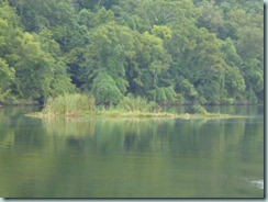
Floating island made up of malfoil and anything that will grow on top.

Started to dock a Shellmound Park at the free docks but the wind was up and I was tired so I hit a small embayment and went over to the free docks the next day. Stayed there Monday night and left for Williams this morning

That is all prelude to now.

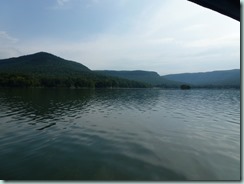
I went through the Tennessee Gorge and it was the best river scenery I have see on this trip. The title of the post refers to the three major geological features of this section of the river.

The first attraction of note is the old Hales Bar powerhouse. Built in 1904 it was the biggest deal of the new century in Tennessee. The hydro electric plant was completed in 1913. This plant was the largest in the country next to The one at Niagara.  The problem was it leaked. It isn’t there anymore

P1010665

P1010666

Just a vacant building

Then I got into the gorge and real mountains for the next 25 miles.
P1010671

P1010673

P1010680

P1010682

Below is the Racoon Mountain Power Station outlet. Eleven hundred feet up is a 520 acre lake that is filled in slack use times and used as hydro power in peak times. Pretty cool huh!

P1010690

About here at the power station the fault is evident when the depth of the water can go from 30 feet to 130 feet. This is from and old earthquake fault and continues for the next  few miles.

P1010693

The river narrows at times to 600 to 700 feet. there are places along the river with turbulent water with names like The Pot, The Skillet, The Suck and my favorite Mongo Chute.

When I left today I thought the current would be down. I was surprised to find as I headed up the river the current increased and my speed was dropping at a constant 2000 rpms from 6.3 mph to below 5. I had checked the outflow at Chickamauga Lock and it was around 7000 cubic feet a second this morning. Little did I know they had raised that to 47,000 cubic feet per second by 11:00 am. I was down to 4.4 mph off and on still running 2000 rpms. Thank my ancestors that the current dropped off near the island and I am anchored securely for the night.

I am in sight of Signal Mountain which is part of the Cumberland Escarpment a big table plateau that extends north and east.

Tomorrow Chattanooga.

While I was writing this deal the big cat boat from the Tennessee Aquarium blew by and waked me. I called on 16 and chewed him out. I will report him. He can apologize all he wants this is a 200 foot channel off the main channel. He should not even be back here on that boat . Well that’s my only bitch for the day.

I just heard thunder. Good night for Honda generator AC cool.

Dr Brad standing by on 16.

This is What it’s Like to live in 110 Square Feet

In long haul on 25/07/2013 at 19:51

Well All the stuff is done. The river has gone back down. I have no excuses. I am leaving here in one week. I am heading East. I am headed up river to the last good anchorage on the Little Tennessee River. The water is clear to 15 feet and the water temperature is near 65 degrees.

Get it on. No big pics just where I live in 110 square feet with a 28 year old woman. She’s small but has good lines and has supported my every move. She’s not high maintenance but you gotta come when she calls. Check out the following video.

http://www.youtube.com/watch?v=9sgsnOmJCNw

Dr Brad standing by on 16

A guy told me he only had 2 weeks to check out the Tennessee River watershed and asked me what to do. I told him to go over to that rock, sit down, and cry.

300 Miles Walking on Water

In On the river, Uncategorized on 04/09/2012 at 18:17

Well My GPS trip meter says that I have gone 308 miles since leaving Pebble Isle. I am on Bledsoe Creek at mile marker 248.5 LDB of the Cumberland River. I stayed in Nashville waiting for the rain that never came and on Labor Day instead of pay for dockage that was busting the budget I shoved off.

9/3 was a long 44 mile day against the current and “walking on water “ at 4-5 mph. When I hit the lock at Hickory dam it decided to rain, fog and turn into an instrument only ride. I had the coordinates for an anchorage called Skinny Dip within 2 miles of the dam and here we go. Between GPS, compass and satellite pictures I hit it on the button. I had come from Harpeth Creek the only anchorage between Nashville and the dam a long day at the wheel. Believe me 8 hours at the helm of a small boat with barge traffic, current , paranoia about the engine – there is no place to stop- this old doc was ready for a toddy.

Here are some pictures

P1000788P1000782

What were those clouds

P1000754

Honey Suckle growing like weeds

P1000805

Free cool stuff

P1000832

P1000854

P1000918

P1000956

P1000959

on and on you gotta love it.

The big weakness is that bunches of people have been down this river forever over and over. I get sucked in like a good chip and dip and want to keep going to the next bend the next turn the next … don’t want to stop. This is addictive.

Not sure where I’ll be tomorrow night but it it will be on the water.

P1000475

This is a cumulus cloud being blown apart by upper level dry winds. It is technically a cumulus fractus with a stratus base but I like Toucan cloud the best

Write me if you still have the strength

Doc Brad Standing by on 16.

Near One of Twenty Thrift Shops

In Don't waste poverty on 22/02/2012 at 12:42

Not much, just can’t remember if I put this up or not. Visiting thrift stores in Waverly is second only to going to Goodwill In Camden.

Below is a west Tennessee health spa. 0127121040

Write me if you still have the strength

I just checked and I did post this.

I picked the wrong month to quit smoking!!!!